ArcGIS Explorer and Terrain
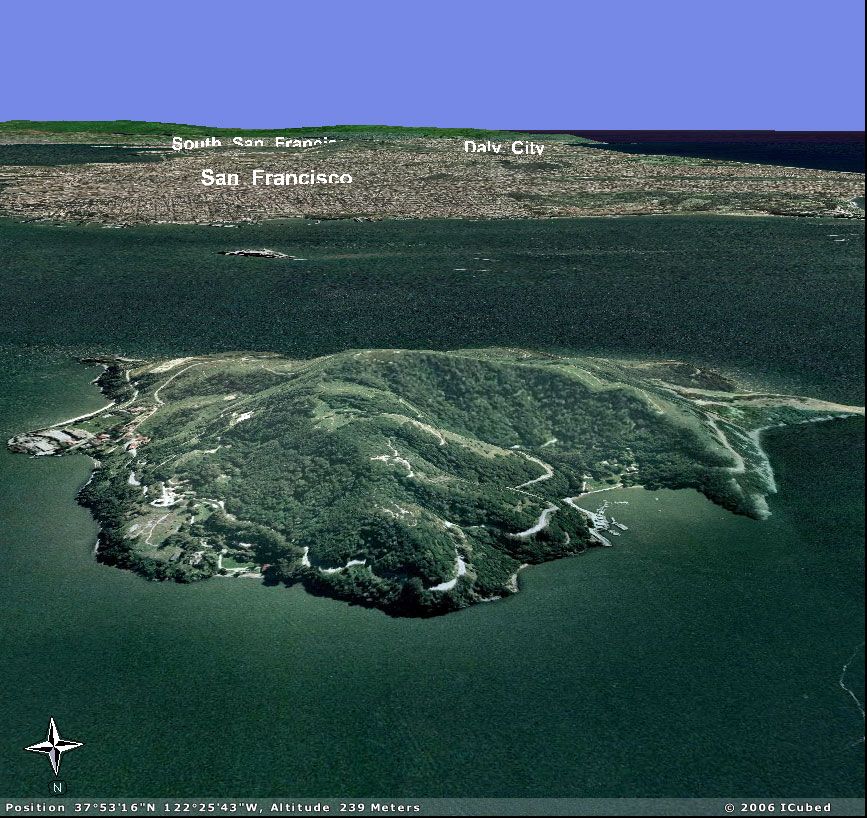
A couple people emailed and IM’d me about the terrain in AGX. I haven’t really look too far into terrain yet, but it is very similar to how Google Earth looks and works. Take this view from Angel Island in the San Francisco Bay looking back toward the City of San Francisco. Take a look at how the place name labels for South San Francisco and Daly City are partially hidden by the Twin Peaks and Mount Davidson. (click image for larger view)
 AGX-SFO
On top of all this Beta 2 of ArcGIS Server 9.2 has been working its way out of Redlands so soon we’ll really be able to start working with some really slick stuff with ArcGIS Explorer and ArcGIS Server (task framework, 3D Globe Services).
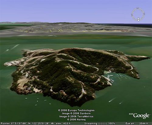
Update - Someone asked to see the same view in Google Earth 4 for comparison. I don’t have it installed at work, but a friend was kind enough to get a similar view with the terrain quality turned up all the way. Take a look and compare.
 ge_example.jpg