Where I Lose My Mind Thinking About GeoDesign
There is no such thing as a GeoDesigner
To understand what GeoDesign is you have to drop any ideas of it being a profession. Yes, that means you don’t have to worry about little Timmy growing up to be a GeoDesigner. I sat for almost a day listening to people argue about an ontology for us to argue about a definition of GeoDesign. Yea, you read that right, ontology has been added to the list of drinking words at any GeoDesign summit.
After that first day, I was a little shaken by what I saw but a night’s sleep clears the mind. People arguing about ontologies are only concerned about either writing about GeoDesign or teaching it. The 99.999% of the rest of us can move on and not worry about such minutia as the term dashboard (I think the point was calling a website information panel a dashboard is offensive to dashboards) being offensive.
That all said, we all agreed that there is nothing called a GeoDesigner and we all took a blood oath to never let such a job be created.
Gentlemen, you can’t fight in here. This is the GeoDesign Room!
What’s The Point Then?
OK, so we reject the idea of creating an ontology (Ontologies are irrelevant in the age of a Google search. Chew on that thought for a while.) and the idea that we can all go back to school and get our MA in GeoDesign. Why did I bother going to the GeoDesign summit anyway? Clearly, I’ve got better things to do the first week of the year than spend it in Redlands, right?
Clearly no. I’ve said again and again that the Geography needs to be a deeper part of all planning. Sure we’ve all been “doing GeoDesign” since man could first pick up a stick and drew up where the dinosaurs lived so they wouldn’t be eaten (At least that is what The Flintstones taught me about history). Place is critical to any planning and thus whether you are a GeoDesign believer or GeoDesign agnostic, you have to give me the point, “place matters”. Thus, the concepts of GeoDesign matter even if calling it that makes your skin crawl.
Let Us Stop Making Things Complicated
What concerns me about GeoDesign though is that many of the people defining what it is or isn’t seem to live by the theory, complex problems require complex solutions. I don’t know about any of you, but my life and job are complex enough without “design strategies” defined on high. I want simple solutions to my problems because those are the ones that are implemented. Complex ones get stuffed in binders and put on a bookshelf (Yup, I’m pissed my hard work over the years with planners has spent most of its time on the shelf). Time to make that stop!
A Way Forward?
Part of why I didn’t rush out and write about what I saw and heard at the 2011 GeoDesign Summit is that I’m not sure the details of what happened matter. GeoDesign 2011 is in the past and it probably was a good outcome as a second summit. There were some interesting talks, but nothing that I really wanted to jump up and say “Yes!”. What was sorely needed was someone showing how they are going to use “geo” and “design” together in the future. I think we’ve grown beyond proving we all have been doing GeoDesign for years and show how we are going to design (Big “D” or little “d” design; I’m pretty sure I’m making a joke there but I guess you had to be there) in the coming months, years, decades. There is all this big talk about GeoDesign being able to save humanity from ourselves but we continue to show work we did years ago. Aren’t we better than that?
If we commit to using Geo with Design, think about where we’ll be in 2001!
The File Geodatabase API is Available
So I guess there really is news at the Esri FedUC (was beginning to wonder if it was just more of the same from the last year). Esri has finally released its File Geodatabase API. Without having looked into it yet Esri says you can do the following:
- Create, Open and Delete file geodatabases (we be talking about little g, not big g - more GeoDesign jokes for no reason)
- Read the schema of the geodatabase
- All content within a geodatabase can be opened for read access
- Create schema for objects within the simple feature model
- Tables
- Point, Line, and Polygon feature classes
- Feature datasets
- Domains
- Subtypes
- Read the contents of datasets in a geodatabase
- All dataset content within a geodatabase can be read
- Insert, Delete, and Edit the contents of simple datasets:
- Tables
- Point, Line, Polygon, Multipoint, and Multipatch feature classes
- Perform attribute and (limited) spatial queries on datasets
- Spatial queries will be limited to the envelope-intersects operator
A couple of points here. First off there is no raster support. Second, you are totally on your own here. You have total control over screwing up your geodatabases here. Some may want to continue using ArcObjects as it gives you some framework to work within. Lastly, this is a C++ API, while I don’t see the need for .NET or Java “versions” feel free to continue complaining about Esri ignoring you below.
I still can’t believe they finally released this thing.
FME 2011 is in the House
Well that yearly update has happened once again. Safe Software has released FME 2011 on the world. Rather than rehash some good resources on the subject, let me point you to a couple that should showcase what is new:
- Dale Lutz: FME 2011: A Retrospective on Today’s Release - very nerdy look at what it took to get FME 2011 out the door
- FME 2011: Spatial Data at Your Command - The official guide to what’s new (spoiler: lots of LiDAR).
- Matt Ball: FME 2011 Takes on Point Clouds - More LiDAR goodness.
I’m looking forward to working with 2011 myself. WeoGeo’s ETL functionality is built on Safe’s FME Server which is why I’m never worried a customer will come up with a format that FME doesn’t support (unless it is cough Revit cough Dale cough Don cough).
Now that 2011 has happened I’m looking forward to the 2012 beta builds.
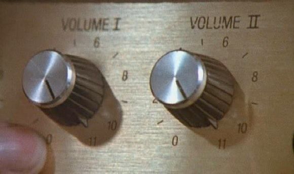 Goes to 11
pause FME goes to eleven!
Google Releases More Oblique Imagery in Google Maps
So there you go, 45-degree imagery update for various U.S. cities.
…the Geo Imagery team has just rolled out some refreshed 45 degree imagery for a number of places in the United States. So whether you already miss the places you may have visited over the holiday season, or you’re looking for new vacation spots to travel to this year, you can now escape the winter weather and check them out virtually from the comfort of your warm and dry home.
So how long to Pictometry’s lawyers start making a fuss?
Oblique images in Google Maps? I see nothing!