19 Years and 2,362 Posts
I mean we’ve been saying it since Elon had bought Twitter, but the deed is done.
The social network formerly known as Twitter has officially adopted X.com for all its core systems. That means typing twitter.com in your browser will now redirect to Elon Musk’s favored domain
I was talking to a good friend over email last month and he had this to say:
The fun days of early twitter and before that blogging certainly made our industry more fun — thanks so much for your key role in that. Sadly those days seem to be gone and I don’t know where to find the modern equivalents.
He is so right, I’m not sure how important my role was in the whole Twitter Geospatial world was, but that grouping we had back then was some of the best sharing of ideas and opinions I’ve ever been part of. I find myself rarely sharing anything spatial on Twitter anymore, mostly it is where I go to complain about the San Francisco Giants, Los Angeles Lakers or Arizona State Sun Devils. And most of that is just shouting into the abyss. This leaves no space for any outlet of my thought and feelings on spatial and the such.
Hence I’m back to blogging, I feel like this has always been the best format for longer form thoughts and given I control the content vs some insane emerald mine heir this is better for my sanity. I am laughing at some of your still using RSS readers (heck I’m one) and having this post show up in your feed after many years. Thanks for never unsubscribing and stay tuned!
Book Review: Hands-On Azure Digital Twins: A practical guide to building distributed IoT solutions
Finished reading: Hands-On Azure Digital Twins: A practical guide to building distributed IoT solutions by Alexander Meijers
I’ve been working with Digital Twins for almost 10 years and as simple as the concept is, ontologies get in the way of implementations. The big deal is how can you implement, how does one actually create a digital twin and deploy it to your users.
Let’s be honest though, the Azure Digital Twin service/product is complex and requires a ton of work. It isn’t an upload CAD drawing and connect some data sources. In this case Meijers does a great job of walking through how to get started. But it isn’t for beginners, you’ll need to have previous experience with Azure Cloud services, Microsoft Visual Studio and the ability to debug code. But if you’ve got even a general understand of this, the walk throughs are detailed enough to learn the idiosyncrasies of the Azure Digital Twin process.
The book does take you through the process of understanding what an Azure Digital Twin model is, how to upload them, developing relationships between models and how to query them. After you have an understanding on this, Meijers dives into connecting the model to services, updating the Azure Digital Twin models and then connecting to Microsoft Azure Maps to view the model on maps. Finally he showcases how these Digital Twins can become smart buildings which is the hopeful outcome of doing all the work.
The book has a lot of code examples and ability to download it all from a Github repository. Knowledge of JSON and JavaScript, Python and .NET or Java is probably required. BUT, even if you don’t know how to code, this book is a good introduction to Azure Digital Twins. While there are pages of code examples, Meijers does a good job of explaining the how and why you would use Azure Digital Twins. If you’re interesting in how you can use a hosted Digital Twin service that is managed by a cloud service, this is a great resource.
I felt like I knew Azure Digital Twins before reading this book, but it taught me a lot about how and why Microsoft did what they did with the service. Many aspects that caused me to scratch my head became clearer to me and I felt like this book gave me additional background that I didn’t have before. This book requires an understanding of programming but after finishing it I felt like Meijers’ ability to describe the process outside of code makes the book well worth it to anyone who wants to understand the concept and architecture of Azure Digital Twins.
Thoroughly enjoyed the book.
A GIS Degree
My son decided to change majors from biodesign to GIS. I had a short moment when I almost told him not to bring all this on himself but then thought differently. I could use my years of experience to help him get the perfect degree in GIS and get a great job and still do what he wants.
 ASU Seal
He’s one semester into the program so he really hasn’t taken too many classes. There has been the typical Esri, SPSS and Google Maps discussion, but nothing getting into the weeds. Plus he’s taking Geography courses as well so he’s got that going for him. Since he’s at Arizona State University, he’s going through the same program as I did, but it’s a bit different. When I was at ASU, Planning was in the Architectural College. Now it’s tied with Geography in a new School of Geographical Sciences & Urban Planning.
I have to be honest, this is smart, I started my GIS career working for a planning department at a large city. The other thing I noticed is a ton of my professors are still teaching. I mean how awesome is that? I suddenly don’t feel so old anymore.
 ASU Geography
I’ve stayed out of his classes for the past semester in hopes that he can form his own thoughts on GIS and its applicability. I probably will continue to help him focus on where to spend his electives (more Computer Science and less History of the German Empire 1894-1910). He’s such a smart kid, I know he’s going to do a great job and he was one who spent time in that Esri UC Kids Fair back when I used to go to the User Conference. Now he could be getting paid to use Esri software or whatever tool best accomplishes his goals.
I plan to show him the Safe FME Minecraft Reader/Writer.
April 30, 2022 connor esri geography GIS Thoughts user conference
GIS and Monitors
If there is one constant in my GIS career, it is my interest in the monitor I’m using. Since the days of being happy for a “flat screen” Trinitron monitor to now with curved flat screens, so much has changed. My first GIS Analyst position probably had the worst monitor in the history of monitors. I can’t recall the name but it had a refresh rate that was probably comparable what was seen in the 1960s. It didn’t have great color balance either, so I ended up printing out a color swatch pattern from ArcInfo and taped it on my wall so I could know what color was what.
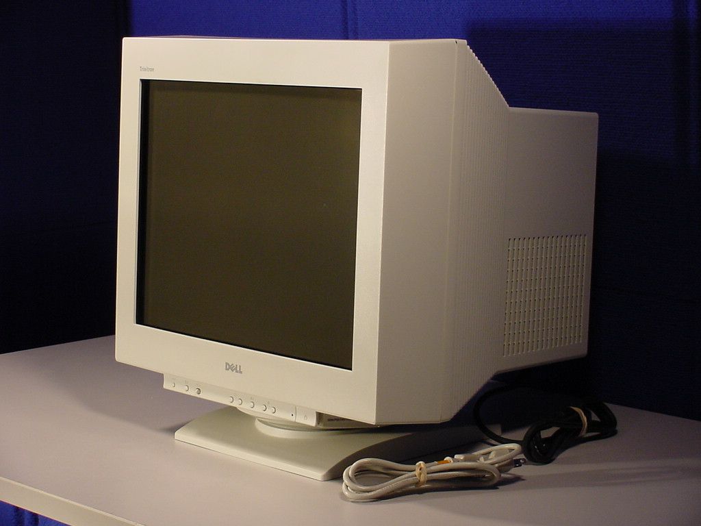 Dell P1110 21” Trinitron CRT Monitor
I stared for years at this monitor. No wonder I need reading glasses now!
Eventually I moved up in the world where I no longer got hand-me-down hardware and I started to get my first new equipment. The company I worked for at the time shifted between Dell and HP for hardware, but generally it was dual 21” Trinitron CRTs. For those who are too young to remember, they were the size of a small car and put off enough heat and radiation to probably shorten my life by 10 year. Yet, I could finally count on them being color corrected by hardware/software and not feel like I was color blind.
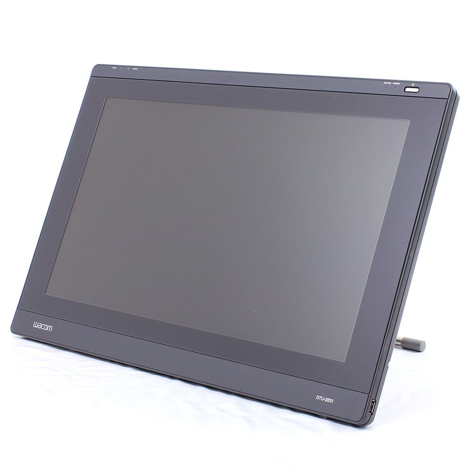 Wacom DTU-2231
It wasn’t sexy but it had a cool look to it. You could drop it flat to write on it like a table.
Over 11 years ago, I was given a Wacom DTU-2231 to test. You can read more about it on that link but it was quite the monitor. I guess the biggest change between now and then is how little that technology took off. I guess if you asked me right after you read that post in 2010 what we’d be using in 2020, I would have said such technology would be everywhere. Yet we don’t see stylus based monitor much at all.
These days my primary monitor is a LG UltraFine 24” 4k. I pair it with another 24” 4K monitor that I’ve had for years. Off to the other side is a generic Dell 24” monitor my company provided. I find this setup works well for me, gone are the days where I had ArcCatalog and ArcMap open in two different monitors. Alas two of the monitors are devoted to Outlook and WebEx Teams, just a sign of my current work load.
I’ve always felt that GIS people care more about monitors than most. A developer might be more interested in a Spotify plugin for their IDE, but a GIS Analyst care most about the biggest, brightest and crispest monitor they can get their hands on. I don’t always use FME Workbench these days, but when I do, it is full screen on the most beautiful monitor I can have. Seems perfect to me.
Are Conferences Important Anymore?
Hey SOTM is going on, didn’t even know. The last SOTM I went to was in 2013 which was a blast. But I have to be honest, not only did this slip my mind, none of my feeds highlighted it to me. Not only that, apparently Esri is having a conference soon. (wait for me to go ask Google when it is) OK, they are having it next week. I used to be the person who went to as much as I could, either through attending or invited to keynote. The last Esri UC I went to was in 2015, 6 years ago. As I said SOTM was in 2013. FOSS4G, 2011. I had to look up, the last conference that had any GIS in it was the 2018 Barcelona Smart City Expo.
So with the world opening back up, or maybe not given whatever greek letter variant we are dealing with right now, I’ve started to think about what I might want to attend and the subject matter. At the end of the day, I feel like I got more value out of the conversations outside the convention center than inside. So probably where I see a good subset of smart people hanging out. That’s why those old GeoWeb conferences that Ron Lake put on were so amazing. Meeting a ton of smart people and enjoying the conversations, rather than reading Powerpoint slides in a darkly lit room.
Hopefully we can get back to that, just need to keep my eye out.
July 13, 2021 conference foss4g Smart City Expo SOTM Thoughts user conference
Unreal and Unity are the new Browsers
Someone asked me why I hadn’t commented on Cesium and Unreal getting together. Honestly , no reason. This is big news honestly. HERE, where I work, is teaming up with Unity to bring the Unity SDK and the HERE SDK to automotive applications. I talk about how we used Mapbox Unity SDK at Cityzenith (though I have no clue if they still are). Google and Esri have them too. In fact both Unreal and Unity marketplaces are littered with data sources you can plug in.
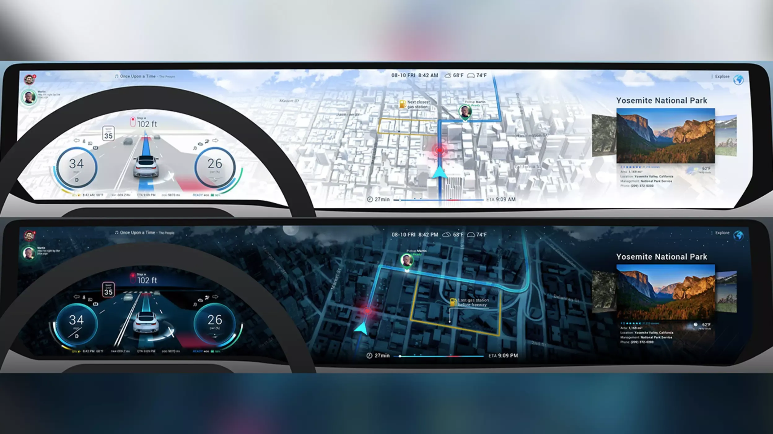 HERE Maps with Unity
This is getting at the core of what these two platforms could be. Back in the day we had two browsers, Firefox and Internet Explorer 6. Inside each we had many choices of mapping platforms to use. From Google and Bing to Mapquest and Esri. In the end that competition to make the best API/SDK for a mapping environment drove a ton of innovation. What Google Maps looks like and does in 2021 vs 2005 is amazing.
This brings up the key as to what I see happening here. We’ll see the mapping companies (or companies that have mapping APIs) deliver key updates to these SDK (which today are pretty limited in scope) because they have to stay relevant. Not that web mapping is going away at any point, but true 3D world and true Digital Twins require power that browsers cannot provide even in 2021. So this rush to become the Google Maps of 3D engines is real and will be fun to watch.
Interesting in that Google is an also-ran in the 3D engine space, so there is so much opportunity for the players who have invested and continue to invest in these markets without Google throwing unlimited R&D dollars against it. Of course it only takes on press release to change all that so don’t bet against Google.
April 12, 2021 bing cesium digital twin esri here mapbox mapquest microsoft Thoughts unity unreal engine