Is FTP access the best we can do
I can almost predict that every conversation about data sharing will have one person stand up and declare, “Just give me FTP access and I’ll be fine”. I used to think that way and while I probably still would like file based access to datasets, I just can’t see FTP being a viable data transfer method anymore. Just it makes it easy to grab a data dump, but there isn’t anything that allows users to know if the data has been updated (other than I suppose checking the metadata). So many times I see people using old data because they have no idea data has been updated. Personally I don’t like the idea that I’m offering up spatial data web services for data I don’t control and most others should be worried as well. Users want to grab data from the source, not some middle man who probably knows less about the data than the creator.
There has been a huge jump into SDI since the pork bandwagon started up in Washington and I’ll be honest… I haven’t paid much attention. One thing I am sure of is I don’t want to see something introduced that has two choices, WxS and FTP. Data needs to be both discoverable and usable and I’m not sure WxS and FTP get us there. WxS no matter what defenders might say is not discoverable and FTP is not secure and has no method of tracking changes.
AtomPub to me looks like the best method of publishing and sharing datasets. There is a huge risk here of inventing something new when a superb solution already exists. Workflows change quickly and WxS/FTP can’t adjust sprightly enough. Read “How to GET a Cup of Coffee” and think about how easier this could all be.
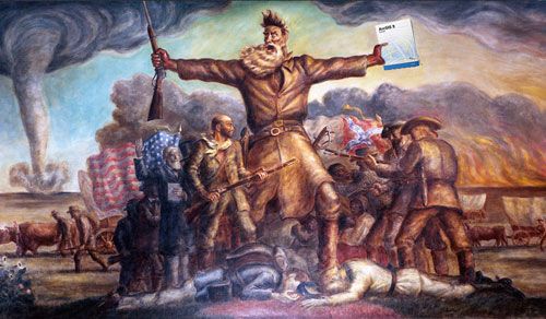
Gatekeepers want to limit you to FTP/WxS so that you can’t change the world.
 Gatekeepers want to limit you to FTP/WxS so that you cant change the world…
SOAP is for cleaning…
Of course this is not surprising in the least bit, but Google is abandoning their SOAP API to focus on their RESTful APIs. Most developers, myself included, prefer working with RESTful services and I’m interested in seeing if other companies will start “retiring” their SOAP APIs for their newer RESTful ones. ESRI, MapGuide, and GeoServer are all great RESTful implementations, but they are still young and immature. Just looking at the ESRI ArcGIS Server Mashup Challenge submissions, you can see the sheer number of REST API, JSAPI, Flex API projects and the lack of Web ADF projects. As these RESTful APIs get more mature, it is clear that ESRI SOAP APIs are destined to follow Google’s SOAP APIs into depreciation.
Even John Brown looked at ESRI’s RESTful API for salvation.
 Even John Brown looked at ESRIs RESTful API for salvation.
ESRI Updates their JavaScript API and Google Extender to version 1.3
Sure this was news last week, but it can’t hurt to revisit it. ESRI has released an update to their JavaScript API and Google Extender to version 1.3. Check those links to see what has been updated and make sure you update your pages to take advantage of the update:
    <link rel="stylesheet" type="text/css" href="http://serverapi.arcgisonline.com/jsapi/arcgis/1.3/js/dojo/dijit/themes/tundra/tundra.css">
    <a href="http://serverapi.arcgisonline.com/jsapi/arcgis/ v=1.3">http://serverapi.arcgisonline.com/jsapi/arcgis/ v=1.3
or
<a href="http://serverapi.arcgisonline.com/jsapi/gmaps/ v=1.3">http://serverapi.arcgisonline.com/jsapi/gmaps/ v=1.3I don’t see any update to the Virtual Earth Extender and the docs still seem to reference v1.2 (not that anyone really uses the VE Extender anyway).
Update: Apparently the Virtual Earth extender was updated to 1.3. I suppose ESRI hasn’t updated their doc just yet.
Update 2: A couple people have asked, yes you can change the reference from 1.2 to 1.3 and publish. Aren’t JavaScript APIs much easier to use
ESRI FedUC “News”
Dave Smith has blogged about the first day “highlights” and I have to say I’m not impressed with the FedUC this year. Not much news coming out which is surprising since most people I know on the east coast are treating it at their UC this year (travel to San Diego is not happening for many people). The FedUC has always been more about application of technology than anything else so I guess we shouldn’t be surprised that the big news is ArcGIS Explorer Build 900 being showcased.
I suspect the real news will happen at the Business Partner Conference and Developer Summit where we’ll learn more about ArcGIS 9.4 and get some hands on with ArcGIS 9.3.1. Maybe we’ll hear more about the new Silverlight API which I was thinking would have been shown more than it was at the FedUC.
I guess for now we’ll just have to imagine what this means since no one is explaining it.
…ESRI is introducing the concept of ‘layer packages’ which they believe will facilitate better data sharing. Layers referencing features can be packaged as an email or sent to the ‘cloud’ as a searchable data file. ‘To me, this is a big deal,’ said Dnagermond [sic]. Users will share the data and the knowledge acquired in creating their data. ESRI see users setting up a communities to share data but only those working on the project can have access to it. For those in secure environments this will be able to be used in their own back office environment.
the cloud eh?