Flickr Mapping
Homer tries to make sense of mapping
 Homer tries to make sense of mapping
Dan Catt at geobloggers blogged over a week ago about Flickr about how they were using WOE ID to generate polygons of places that people have tagged in Flickr. A couple people have emailed me on how worthless this exercise is and how arbitrary it is. The Flickr Developer Blog goes into some more detail about the how and why Flickr is doing this and I think that should give everyone who doesn’t understand why this is important some better context. Personally I find it extremely interesting to see how people understand what place they are taking a photo at. A lot of this can all be tied back into Neogeography and what makes an expert. I’d wager people are more careful to geotag their photos in areas they are familiar with and less so when they are traveling. I don’t have enough photos tagged in Flickr, but I’d love to see maps from some larger Flickr users to see how they geotag the world.
What Flickr has is a way to visualize how people are geotagging their photos and they appear to be learning about to improve the process. I think this is a great application of technology to help better understand how humans perceive** **location.
ArcGIS 9.3 Service Pack 1 is available
As I’m sure many have seen, ArcGIS Service Pack 1 is available on ESRI’s servers. I’m interested to see how the new error reporting has improved the first Service Pack over previous Service Packs. ESRI is still going to release a Service Pack a quarter so don’t worry about the future. The links below go to the download page which also has info about the what fixes were included.
- ArcGIS 9.3 Service Pack 1
- ArcSDE 9.3 Service Pack 1 (They just can’t drop that ArcSDE name can they?)
- ArcIMS 9.3 Service Pack 1
- ArcGIS Image Server 9.3 Service Pack 1 (Still not part of the ArcGIS Server package)
- ArcSDE 9.3 Service Pack 1 geodatabase direct connect for 9.2 clients setup (For those still on 9.2 and want to connect to 9.3)
Nothing about the Service Pack 1 update on the ESRI Support Blog but that blog has been spotty so I’m not surprised.
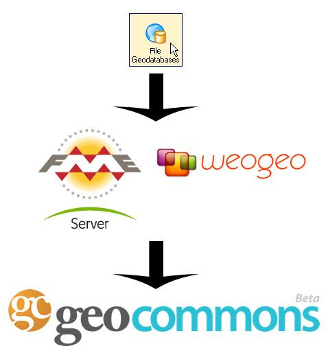
Sharing the File Geodatabase
There are really good reasons to use the File Geodatabase in the ESRI world over the shapefile and Personal Geodatabase, but it doesn’t mean it is easy to share. Sean Gorman knows that the more file formats he supports, the more likely people (especially GIS pros) will be using GeoCommons. I suppose the simple answer for Sean is to buy a license of FME Server and support everything and anything people upload. The cost of that solution might not make business sense just yet for him so I suppose is the lack of ESRI Geodatabase support (or any other format) limiting you when you want to share data? I like the idea of uploading a Geodatabase full of datasets at one time, but sharing a folder/file based dataset is difficult enough on a LAN, let along the internet. Is converting to shapefiles too much to ask for people who want to share data on services such as GeoCommons?
WeoGeo partnered with Safe Software to bring this kind of datasharing (among other features of FME Server) to the cloud?web so there might be solutions that are cheaper than outright licensing FME Server to bring translate capability to Web 2.0 services. If that can be coupled with Amazon Web Services pricing (pay for what you use rather than a traditional license) there could be something that many people take advantage of.
And of course you could export out any layer in GeoCommons Finder! to any of the 200+ FME supported formats.
 And of course you could export out any layer in GeoCommons Finder! to any of the 200+ FME supported formats.
Geowanking moving to O’Reilly
Brady has just posted the news on the Geowanking list. Full text after the jump.
Howdy!
Joshua has been quietly looking for a good home for Geowanking for a while. He approached O’Reilly and we have agreed to support the list.
I’d like to thank Joshua for starting the list and helping the community grow. He’s put in a lot of time and energy for us. Thanks!
O’Reilly is invested in the geospace. Where 2.0 is one of our strongest conferences and I consider the geowanking community to be the conference’s primary constituent. So when we were asked to take on the list it was an obvious yes to me. We want to support this community and help it grow.
What does this mean?
- Later today or tomorrow we will be moving the list to O’Reilly servers.
** The domain will change.** Joshua is keeping?http://burri.to, but is giving us geowanking.org. The new list address will be??geowanking@geowanking.org
The archives and your subscriptions are intact, but you may need to reset your user password and digest settings.
The archives will still be public.
Please mail me for admin or other issues about the list. Laura Painter, an O’Reilly employee, has spent a lot of time on this (thanks!). She’ll be monitoring the list for technical hiccups.
What about the future? We’ve got a couple of ideas for how to support the community and I would love to hear your thoughts on them. I’ve been thinking that a planet installation on geowanking.org would be great.Any others?
Cheers,
brady
Kudos to O’Reilly for stepping up and keep Geowanking running.