LibLAS 1.0 Beta 1, GeoNetwork graduates, OSGeo4W looks for testers and ESRI looks at SEO
libLAS has moved forward and has been released as 1.0.0b1 in the hopes of attracting more testers. For those who haven’t been following, “libLAS is a BSD library for reading and writing ASPRS LAS version 1.0 and 1.1 data. LAS-formatted data is heavily used in LiDAR processing operations, and the LAS format is a sequential binary format used to store data from sensors and as intermediate processing storage by some applications.” If you deal with LiDAR on a regular basis, you might want to take a look at libLAS due to its integration with GDAL (see Hobu’s comment below). While I haven’t taken this release out for a spin yet (not dealing with LiDAR in the new job), I’m sure it goes without saying that it is a beta product so be prepared for “issues”. Yet if the goal is to get better LiDAR tools, a little pain now could result in good things for all.
In more OSGeo news, I saw that GeoNetwork graduated incubation last week. GeoNetwork has really flown under the radar and I’m pretty sure it will start to get more notice as time goes on and the need for geospatial/metadata catalogs increases.
Heck, why not one more OSGeo note? The great Frank Warmerdam posted that OSGeo4W is looking for testers and contributors. OSGeo4W can somewhat be thought of as superseding MS4W and FWTools, but it isn’t that simple. Basically it is an installer for OSGeo windows packages that allows users to easily install different OSGeo projects. Windows users wanting to get into the open source GIS world should sit up and take note.
Lastly I find it very interesting that ESRI is apparently looking for a [SEO](http://en.wikipedia.org/wiki/Search_engine_optimization) specialist (HT APB). I find that using the Google to search the ESRI forums, knowlege base articles and help is virtually impossible. I can only hope that they plan to get their support and help indexed by the world’s search engines. Of course we’ve been waiting for improved EDN search for years so I won’t be holding my breath.
Tell me again what GeoPDF does…
Ever since the news that Adobe Acrobat 9 would support “mapping”, I’ve been getting emails from people asking what this does to GeoPDF. I’m sure the GeoPDF team has been fielding the same questions and has blogged about what they think are the important points of GeoPDF.
GeoPDF is a geospatial extension to the Adobe PDF file format, from TerraGo Technologies. It is used to present GIS and mapping data in a standard Adobe Systems PDF. This extension adds a coordinate transformation matrix and other metadata to allow transformation of PDF coordinates to a projected Cartesian coordinate system. GeoPDFs often include other advanced PDF features such as layers and object data which can add significant GIS functionality to the file, particularly when used with the TerraGo Technologies plugin to Adobe Reader.
Unfortunately, that description doesn’t do enough to convince me that GeoPDF is a viable format moving forward. I’ve barely run into GeoPDF over the years so believe me when I say I’m a GeoPDF novice and I could be missing the boat here. I’m sure there are very good reasons to use GeoPDF and I know some people who seem to believe in the format. GeoPDF of course requires an extra step to create and take advantage of the format, thus TerraGo really needs do a better job of getting out “the why” to use GeoPDF.
Otherwise it will just become a niche format.
Update: Commentator Kevin has some points as to why GeoPDF is powerful.
Portable GIS Version 1.2 Posted
I am excited to read on Jo Cook’s blog that version 1.2 of Portable GIS has been released. The concept of being able to either try out or even use software without having to install it, is how we’ll get GIS applications in the hands of everyone. Plus who doesn’t want to carry GIS on your key chain? That isn’t geeky, it is being prepared!
Note: there have been some problems with the download server, but all seems well as of this moment.
 USB Drive
Putting Open Source GIS software in your pocket
Get to know ArcPad AXF
 ArcPad
The excellent ArcPad Team Blog has info on the new storage format for ArcPad 7.1.
Prior to ArcPad 7.1, shapefiles were ArcPad’s most common spatial file format for features. Shapefiles are great for many applications, but shapefiles lack the capabilities to support more sophisticated relational database requirments that exist in the ArcGIS Geodatabase. So ArcPad 7.1 introduced the AXF format, which we like to refer to as a “lightweight geodatabase”.
As a user of ArcPad at my old job, I really hated storing information in the shapefile format. Actually I hate shapefiles, period. Any format that requires you to maintain at least 3 separate files to ensure they work is a bad idea in my book. I liked that the ArcPad team build upon the Microsoft’s SQL Server Compact Edition platform.
Time to bury the shapefile format!
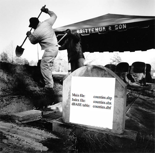 Kill Shape