Sean Gillies Makes “Fiona for Rasters”

I’m a vector guy, I love nodes and even lines that connect nodes. Don’t even get me started on polygons! But rasters are still very much part of my life. I’ve used FME quite a bit to manipulate them because of it’s speed and lack of “legacy” COM madness. But even it has overhead that I don’t want all the time. I’ve written quite a bit about Fiona and how it really simplifies vector workflows so you better believe I sat up when I saw Sean’s announcement of Rasterio.
Ever since I wrote Fiona, I’ve been asked if I have plans to do something similar for geospatial raster data. Having been out of the raster business for a few years, I always said “no serious plans, just blue-sky ideas.” Today, I’m back in satellite image processing and very much want and need something like Fiona-for-rasters. Rasterio is my attempt to write such a Python package.
You’ll remember that Sean joined MapBox a couple months ago and clearly he’s been working on their cloudless satellite efforts. I’m sure the first thing he needed was better tools for manipulating raster images. If you use GDAL you’ll be really excited about Rasterio. Like OGR is to Fiona, GDAL is to Rasterio. Plus if your a NumPy user (if you aren’t, you should be) you can read rasters right into your NumPy arrays. Let that sink in for a moment. I’m so looking forward to the 4 day holiday weekend to start playing with Rasterio.
Sean Gillies Makes “Fiona for Rasters”
I’m a vector guy, I love nodes and even lines that connect nodes. Don’t even get me started on polygons! But rasters are still very much part of my life. I’ve used FME quite a bit to manipulate them because of it’s speed and lack of “legacy” COM madness. But even it has overhead that I don’t want all the time. I’ve written quite a bit about Fiona and how it really simplifies vector workflows so you better believe I sat up when I saw Sean’s announcement of Rasterio.
Ever since I wrote Fiona, I’ve been asked if I have plans to do something similar for geospatial raster data. Having been out of the raster business for a few years, I always said “no serious plans, just blue-sky ideas.” Today, I’m back in satellite image processing and very much want and need something like Fiona-for-rasters. Rasterio is my attempt to write such a Python package.
You’ll remember that Sean joined MapBox a couple months ago and clearly he’s been working on their cloudless satellite efforts. I’m sure the first thing he needed was better tools for manipulating raster images. If you use GDAL you’ll be really excited about Rasterio. Like OGR is to Fiona, GDAL is to Rasterio. Plus if your a NumPy user (if you aren’t, you should be) you can read rasters right into your NumPy arrays. Let that sink in for a moment. I’m so looking forward to the 4 day holiday weekend to start playing with Rasterio.
F.C.C. Uses Android App to Map Speed of Mobile Networks
 FCC Logo
Ever since I picked up my iPad Air LTE (AT&T) earlier this month I’ve been testing the AT&T network to see how much faster it is than Verizon (my work iPhone is Verizon LTE). In my neighborhood AT&T LTE blows Verizon away to the point I attach my iPhone to my iPad hotspot to get faster speeds. But of course what happens in Tempe, AZ doesn’t translate across the country. We’re mostly left with commercials reminding us who the faster network everywhere else. And heaven forbid you ask the question on Twitter.
I’ve used 3rd party tools for this testing but you have to wonder how consistent they are across the network. Well now we’ve got the F.C.C. releasing an Android app to trying answer the question as to real networks speeds across the country.
The Federal Communications Commission has released a mobile speed test app for Android to help the agency crowdsource data about wireless performance across the country. The app, simply named the FCC Speed Test, doesn’t have the best looking design out there, but it doesn’t necessarily need to: once installed, it’ll automatically check a phone’s connection speed in the background when the device is not in use. While that’ll allow individual users to clearly see how well their own data provider is performing, it’ll more importantly allow the FCC to gather a wide amount of data on cellular carriers nationwide — that is, if its app gets enough users.
Now the kicker…
Early next year, the commission intends to release an interactive map online that’ll detail, in general, how well each data provider does in different locations. As the year goes on and it gathers more data, the FCC intends to make the map more and more detailed, adding in more local results, speed variations, and packet loss reports. It’s also promising infographics.
I’m going to go out on a limb here and say that the F.C.C. won’t be releasing PDF maps. I’m totally looking forward to the results. Now being iOS only I’ll have to wait until January to take part and it appears Windows Phone and Blackberry (I guess for all those Fed users) apps will be released as well.
2013 is still the year of the PDF - U.S. Forest Service brags about PDF on mobile
https://twitter.com/marcpfister/status/404302210135101440
Consider this title: “U.S. Forest Service offers new digital maps for mobile devices”
You’d think, “Awesome!” and then quickly read on:
“This mobile app makes it easier than ever to plan your visit to a national forest or grassland,” said U.S. Forest Service Chief Tom Tidwell. “By putting important forest information right at your fingertips, it will encourage more Americans to get outside and explore their forests.”
The digital maps are part of USDA’s work toward reaching President Obama’s initiative to create a paperless government that also provides the American public with better, more accessible information. Online customer surveys also indicated a desire for more online products and information, such as maps. The Forest Service is currently working on the first phase of a website redesign, expected to debut early in 2014, which centers on a map-based tool for planning trips onto our nation’s forests, grasslands and other special places.
Paperless, that’s the first sign things are not good. Paperless usually means one thing….
Doesn’t look awkward at all does it?
The PDF Maps Mobile App, developed by Avenza Systems Inc., is available as a free download from iTunes and the Android Play Store. The app provides access to Forest Service maps, such as motor-vehicle-use maps, which are free while pages from national forest atlases are 99 cents and forest visitor maps are $4.99. Prices are pending for other agency maps.
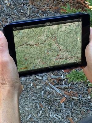
The maps are geo-referenced with the user’s location appearing as a blue dot. The app works on iPhones (3GS or newer) and iPads with WiFi+3G. It also works with Android 4 or newer operating systems on devices with at least 1 gigabyte of memory.
Oh my, not only are we talking about PDF here but we’re talking about charging for free data. But maybe it’s a stopgap measure:
In geographic areas with Internet availability users will be able to use the products with live data. The interactive map is expected to be available on a limited basis starting in March 2014.
Read that sentence a couple of times and try and figure out their plans. National forests with “internet availability” (how’s that for a small subset?) will be able to use “the products” (we talking about PDF Maps Mobile?) with “live data” (which means what?). I guess we’ll just have to wait until next year to see if 2014 will continue PDF maps on mobile. But don’t fear:
Paper maps are still available for purchase online at the National Forest Store.
Sigh….
2013 is still the year of the PDF - U.S. Forest Service brags about PDF on mobile
https://twitter.com/marcpfister/status/404302210135101440
Consider this title: “U.S. Forest Service offers new digital maps for mobile devices”
You’d think, “Awesome!” and then quickly read on:
“This mobile app makes it easier than ever to plan your visit to a national forest or grassland,” said U.S. Forest Service Chief Tom Tidwell. “By putting important forest information right at your fingertips, it will encourage more Americans to get outside and explore their forests.”
The digital maps are part of USDA’s work toward reaching President Obama’s initiative to create a paperless government that also provides the American public with better, more accessible information. Online customer surveys also indicated a desire for more online products and information, such as maps. The Forest Service is currently working on the first phase of a website redesign, expected to debut early in 2014, which centers on a map-based tool for planning trips onto our nation’s forests, grasslands and other special places.
Paperless, that’s the first sign things are not good. Paperless usually means one thing….
Doesn’t look awkward at all does it?
The PDF Maps Mobile App, developed by Avenza Systems Inc., is available as a free download from iTunes and the Android Play Store. The app provides access to Forest Service maps, such as motor-vehicle-use maps, which are free while pages from national forest atlases are 99 cents and forest visitor maps are $4.99. Prices are pending for other agency maps.
The maps are geo-referenced with the user’s location appearing as a blue dot. The app works on iPhones (3GS or newer) and iPads with WiFi+3G. It also works with Android 4 or newer operating systems on devices with at least 1 gigabyte of memory.
Oh my, not only are we talking about PDF here but we’re talking about charging for free data. But maybe it’s a stopgap measure:
In geographic areas with Internet availability users will be able to use the products with live data. The interactive map is expected to be available on a limited basis starting in March 2014.
Read that sentence a couple of times and try and figure out their plans. National forests with “internet availability” (how’s that for a small subset?) will be able to use “the products” (we talking about PDF Maps Mobile?) with “live data” (which means what?). I guess we’ll just have to wait until next year to see if 2014 will continue PDF maps on mobile. But don’t fear:
Paper maps are still available for purchase online at the National Forest Store.
Sigh….
Today’s Hangout:: PostGIS Day Extravaganza Panel
Thanks to Paul Ramsey, Bborie Park, Stephen Mather
, and Josh Berkus for joining me to talk about our favorite spatial database in depth. The video is below and you can read the IRC transcript here.