Arrays in GeoJSON
So my last post was very positive. I figured out how to relate the teams that share a stadium with the stadium itself. This was important because I wanted to eliminate the redundant points that were on top of each other. For those who don’t recall, I have an example in this gist:
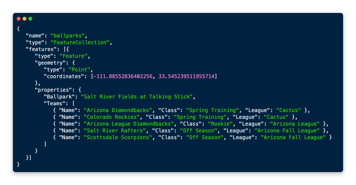
Now I mentioned that there were issues displaying this in GIS applications and was promptly told I was doing this incorrectly:
An array of <any data type> is not the same as a JSON object consisting of an array of JSON objects. If it would have been the first, I'd have pointed you (again) to QGIS and this widget trick https://t.co/4Wfy9OtOtM .
— Stefan Keller (@sfkeller) April 4, 2021
If you click on that tweet you’ll see basically that you can’t do it the way I want and I have to go back to the way I was doing it before:
Unfortunately, the beat way is to denormalise. Redundant location in many team points.
— Alex (@alexgleith) April 4, 2021
I had a conversation with Bill Dollins about it and he sums it up susinctly:
I get it, but “Do it this way because that’s what the software can handle” is an unsatisfying answer.
So I’m stuck, I honestly don’t care if QGIS can read the data, because it can. It just isn’t optimal. What I do care about is an organized dataset in GeoJSON. So my question that I can’t get a definitive answer, “is the array I have above valid GeoJSON code?”. From what I’ve seen, yes. But nobody wants to go on record as saying absolutely. I could say, hell with it I’m moving forward but I don’t want to go down a dead end road.