Possible Data Sources in Apple’s iOS Map
So what do you do on a Friday morning when an editor tells you to get some “exclusive” Apple news on the front page. Clearly this:
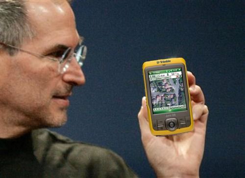
According to trusted sources, Apple has an incredible headline feature in development for iOS 6: a completely in-house maps application. Apple will drop the Google Maps program running on iOS since 2007 in favor for a new Maps app with an Apple backend.
 Apple Navigation
So the iOS map app is really old and busted and this is not exactly news. I’m guessing Lead Dog and Urban Mapping will be along for the ride as well as OpenStreetMap. Apple will probably blend many data sources like their iOS iPhone maps, rather than buy wholesale from Navteq or TomTom.
Preview LeadDog datasets on WeoGeo Market
http://market.weogeo.com/widget.html?query=leaddog&lat=0&lon=-13.00781&zoom=2&layers=BT
WeoGeo Market
Designing Icons for Web Cartography
MapBox just keeps giving and giving! If you haven’t started using Maki yet, you’ll want to get on that bandwagon ASAP. Even the nounproject is getting on board.
Maps are capable of powerfully communicating ideas, clearly visualizing complex data, and adding context to a stories, whether you’re mapping humanitarian crisis in Africa or providing directions to the nearest café. As a designer with MapBox, I’ve been working on and off over the last few months on Maki, an open source icon set made especially for cartography and based on the points-of-interest used in OpenStreetMap. In cartography, points-of-interest include things like restaurants, bus stations, and schools. Maki will eventually grow to include icons for pretty much anything you might want to mark on a map.
This is a clear example of why an open collaborative design process will always win over closed minded dictatorships.
 Agreement
Designing Icons for Web Cartography
MapBox just keeps giving and giving! If you haven’t started using Maki yet, you’ll want to get on that bandwagon ASAP. Even the nounproject is getting on board.
Maps are capable of powerfully communicating ideas, clearly visualizing complex data, and adding context to a stories, whether you’re mapping humanitarian crisis in Africa or providing directions to the nearest café. As a designer with MapBox, I’ve been working on and off over the last few months on Maki, an open source icon set made especially for cartography and based on the points-of-interest used in OpenStreetMap. In cartography, points-of-interest include things like restaurants, bus stations, and schools. Maki will eventually grow to include icons for pretty much anything you might want to mark on a map.
This is a clear example of why an open collaborative design process will always win over closed minded dictatorships.
Agreement
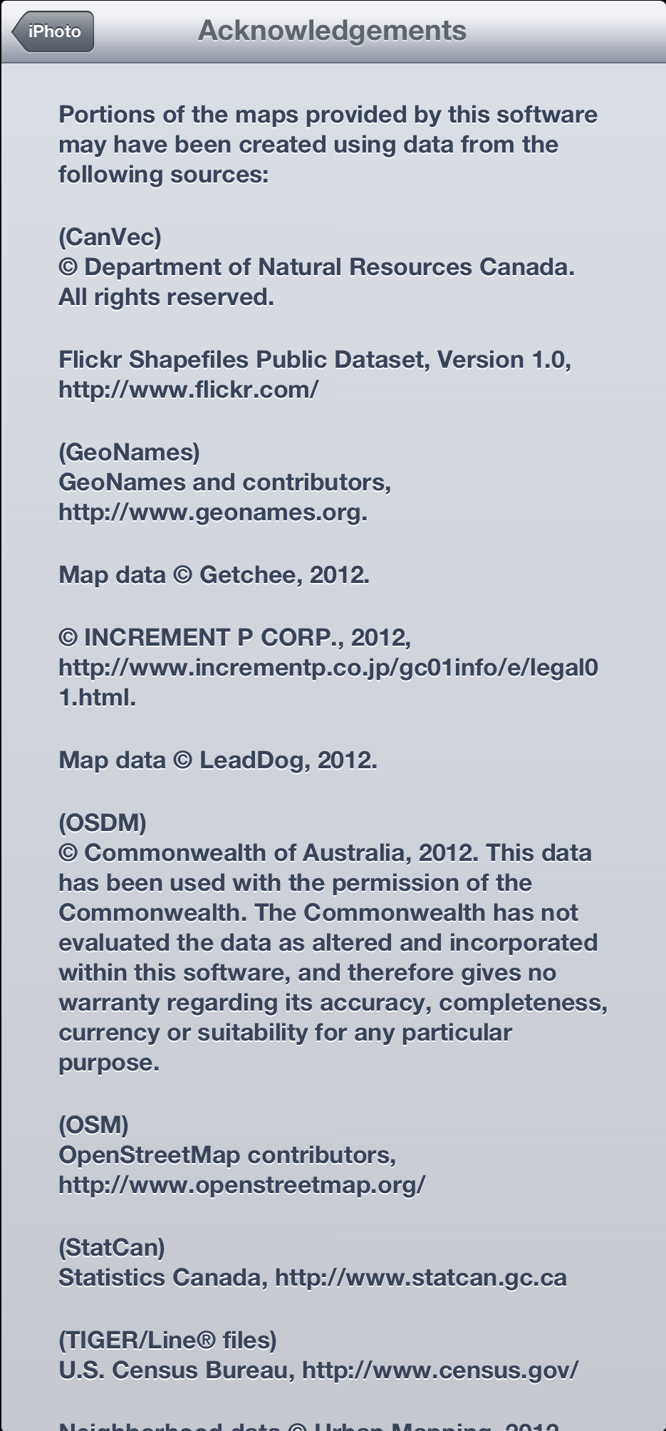
Apple’s iPhoto Maps Now Show Attribution
The last update to iPhoto on iOS finally attributes the map.
 Apple Attribution
You’ll remember there was great speculation about where the data came from. Many people said OSM, I was sure it was TIGER/Line. Well as you can see there is a huge blend of open and free data sources from OSM to TIGER to VMap0 and Geonames. Two commercial sources you may be familiar with are LeadDog and Urban Mapping.
Apple’s iPhoto Maps Now Show Attribution
The last update to iPhoto on iOS finally attributes the map.
Apple Attribution
You’ll remember there was great speculation about where the data came from. Many people said OSM, I was sure it was TIGER/Line. Well as you can see there is a huge blend of open and free data sources from OSM to TIGER to VMap0 and Geonames. Two commercial sources you may be familiar with are LeadDog and Urban Mapping.
Microsoft TerraServer Is No More
So Microsoft TerraServer is finally dead. In its time, I used it to test WMS, but I’m not sure I ever really used it for anything else. Much like LandSat, I’ll shed no tears. It served its purpose and now it must die.
 Lonely
It must have been pretty lonely around the TerraServer offices lately