A Week Off
I’m heading down into the basement for a week. Enjoy the greatness that is David Hasselhoff, Gary Coleman and of course KITT.
What a moment of zen…
 What a moment of zen…
GeoCommons Maker! - the next day
Well kudos for FortiusOne for getting the word out on Maker! especially since the launch was delayed from the original PR blitz. As with most GeoBloggers, I’ve had access to Maker! since last week and have really been impress with its output. Sean has been teasing us for months it seems with the cartographic output of Maker! in his blog posts, so I was glad to finally get my? hands on Maker!. (side note, do you put a period after a product name that ends in a punctuation mark?)
Maker! is the map production portion of GeoCommons and Finder! is the search engine for geospatial data. Together they allow users to create web maps that can be shared with the world. So to get information in Maker!, you first upload your data to Finder! and then add it to your map. The byproduct of this workflow is more data gets added to Finder! and in turn more data is available to the community at large. Freely sharing data is one the core components of GeoCommons (compared to WeoGeo which is more of a marketplace).
Stefan Geens does a good job of showing how the map is created and how you set what we usually refer to the symbology of layers. What I like about this approach is you can bring to light the data in ways that before Maker!, required custom programming to achieve good looking results (if even possible). FortiusOne, according to Sean, worked with cartographic professionals to create the rich (I’m sorry) map production tools. These tools are so good in fact that I’ve heard a couple GIS professionals lament that they’ll be out of a job soon (of course we all know that Maker! will only increase our workloads to produce data for public consumption). What we have here are two really simple tools that allow anyone to upload geospatial content, combine that information with other datasets and then create a wonderful looking map that visually tells a story.
You can argue all day and night about what the GeoWeb is or isn’t, but I think we have an excellent example of what the GeoWeb should be right here. Finder! has discoverable web services of data (with metadata to boot) and Maker! allows you to leverage those services together to create derivative value content to share with the world. Moving forward, the data of GeoCommons should support more OGC services (beyond KML) for those who need that support and the maps created with Maker! should be more easily shared beyond just an web map. But the groundwork is there for sharing data with the world.
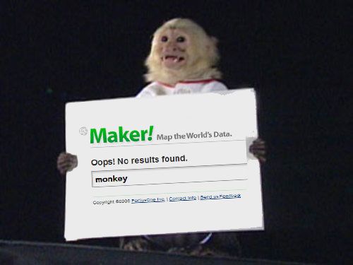
Despite the lack of monkey maps, the GeoMonkey approves of Maker!
 Despite the lack of monkey maps, the GeoMonkey approves of Maker!
GeoCommons Maker! - the next day
Well kudos for FortiusOne for getting the word out on Maker! especially since the launch was delayed from the original PR blitz. As with most GeoBloggers, I’ve had access to Maker! since last week and have really been impress with its output. Sean has been teasing us for months it seems with the cartographic output of Maker! in his blog posts, so I was glad to finally get my? hands on Maker!. (side note, do you put a period after a product name that ends in a punctuation mark?)
Maker! is the map production portion of GeoCommons and Finder! is the search engine for geospatial data. Together they allow users to create web maps that can be shared with the world. So to get information in Maker!, you first upload your data to Finder! and then add it to your map. The byproduct of this workflow is more data gets added to Finder! and in turn more data is available to the community at large. Freely sharing data is one the core components of GeoCommons (compared to WeoGeo which is more of a marketplace).
Stefan Geens does a good job of showing how the map is created and how you set what we usually refer to the symbology of layers. What I like about this approach is you can bring to light the data in ways that before Maker!, required custom programming to achieve good looking results (if even possible). FortiusOne, according to Sean, worked with cartographic professionals to create the rich (I’m sorry) map production tools. These tools are so good in fact that I’ve heard a couple GIS professionals lament that they’ll be out of a job soon (of course we all know that Maker! will only increase our workloads to produce data for public consumption). What we have here are two really simple tools that allow anyone to upload geospatial content, combine that information with other datasets and then create a wonderful looking map that visually tells a story.
You can argue all day and night about what the GeoWeb is or isn’t, but I think we have an excellent example of what the GeoWeb should be right here. Finder! has discoverable web services of data (with metadata to boot) and Maker! allows you to leverage those services together to create derivative value content to share with the world. Moving forward, the data of GeoCommons should support more OGC services (beyond KML) for those who need that support and the maps created with Maker! should be more easily shared beyond just an web map. But the groundwork is there for sharing data with the world.
Despite the lack of monkey maps, the GeoMonkey approves of Maker!
 Despite the lack of monkey maps, the GeoMonkey approves of Maker!
Amazon brings Windows (and SQL Server) to the cloud
The Amazon Web Services Blog says that Amazon will be bringing Microsoft Windows to EC2 this fall.
The 32 and 64 bit versions of Windows Server will be available and will be able to use all existing EC2 features such as Elastic IP Addresses, Availability Zones, and the Elastic Block Store. You’ll be able to call any of the other Amazon Web Services from your application. You will, for example, be able to use the Amazon Simple Queue Service to glue cross-platform applications together.
This is on the heels of the Oracle/Amazon EC2 release from a couple weeks ago. Now that the tools are here, we’ll have to see how well they are adopted by corporate IT administrators who aren’t always open to giving up control of their servers to others.
Mr. Gates saw the value of the cloud early on
 Mr. Gates saw the value of the cloud early on
Stopping Over-engineered GIS Applications

I was thinking the past week about a project that we will start working on soon. Simply put, it is updating a MapObjects IMS application we deployed almost 10 years ago, that is still working. When I saw that it was not only still running, but it was still a critical part of their business workflow, it started me thinking about why such an application was so successful. It obviously wasn’t the technology. Sure the back end runs on Oracle, but even the most ardent MOIMS supporter can’t claim that the Visual Basic application was cutting edge even back then. So that must mean there was something else going on that kept it running when most MOIMS sites are long gone.
Won’t someone please think of the users?
 Wont someone please think of the users?
History of GIS applications tells us one story that repeats itself again and again. There is a horrible habit of pushing over-engineered applications that are not used by the target audience because no one has time to figure out complicated tools. GIS vendors have not discouraged such habits and in some cases encourage them. The GIS world is really good at writing GIS applications for GIS professionals. I think this used to work before GIS and mapping became important in our everyday lives, but now that everyone everywhere is looking at deploying spatial applications focus needs to be put on what the end users are going to be doing with the application.
So back to that old MapObjects application, it did a really good job of doing what it was supposed to do. Display information in a context that the users were comfortable working (the interface was familiar to them) with and meet their requirements (which were obviously well developed), fit within their websites, scaled well (even Visual Basic does that apparently) and wasn’t an obstacle to their workflows. With MOIMS depreciated and the need to connect to more modern ESRI servers and Oracle databases the application needs to be updated, but not because it restricts their business practices and workflows.
Foisting this application on users of a bus system was poorly thought out, but the Google Transit version released a few weeks ago hits the target users right on. The heavy GIS website might meet needs of users in the organizations internally, but externally it really highlights missed opportunities and wasted resources. I’m personally really excited to see if we can replicate the success of the earlier MOIMS application with JavaScript APIs, KML downloads and other new technology and still keep is simple. The key is listen to what the client really wants and be agile enough to deliver simple, focused, and fast products.