ESRI’s EDN Site’s “Purpose”
I was wondering just this week the purpose of ESRI’s EDN site now that they’ve got the Resource Centers online. The ArcObjects Development Blog has some of the thinking behind why EDN is just a placeholder now:
Feedback from the user community, as well as our own technology development goals indicate that developers need information about product installation, architecture, administration, and functional usage as much as any other user, and end-users more and more often are making use of information for product customization, components, scripting, programming, and other resources typically associated with application developers. As our technology continues to grow along with the maturity of information technology, the lines between “user” and “developer” continue to blur and overlap. It makes less and less sense to maintain two sites and have users decide which one to use.
I do like the Resource Centers very much, but the more I think about this move, the more it seems like the same old ESRI response; launch a website and then let it languish until it becomes useless. The support site is stuck in 1999, EDN seems like it was stuck in 2005 and now we’ve got the Resource Centers. I can only hope they don’t fall to the same fate as those before it.
ESRI, I’m just a caveman. I fell on some ice and later got thawed out by some of your scientists. Your methods frighten and confuse me!
 Esri Caveman
Simple Layer List from the ArcGIS Server Using the JavaScript API
Jason Harris of ROK Technologies describes how easy it is to work with the new ESRI ArcGIS JavaScript API.
I thought it was time to put my money where my mouth has been these past couple of months. I have been yapping about how easy the new ArcGIS javascript api is to work with, so I thought I’d share a very simple example.
The ease and speed of developing with the JavaScript/REST API at 9.3 will probably pull many developers back into ESRI who have left over the WebADF. I predicted that we’d see many ArcIMS developers finally move off of working with those wacky AXL XML files and to a very RESTful process.
Even Indiana Gilles likes what ESRI has done! Careful when you grab it though, rocks may still fall on your head…
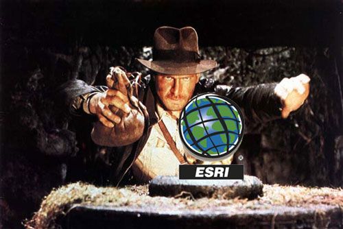 Indiana Esri
Speaking of AXL being a PITA, ESRI’s REST[ful] API uses JSON which in my humble opinion is enough reason to switch off of ArcIMS, I noticed today that Safe Software is now supporting GeoJSON 1.0 in FME. ESRI isn’t supporting GeoJSON with ArcGIS Server, but maybe they will in the future. JSON with ArcGIS Server REST[ful] API is a least a step in the right direction.
Recovering from the weekend
The Monsoon really came into Tempe yesterday afternoon and ended up flooding my backyard, the pool overflowed and all that was between the rushing water and my kitchen was me and a push broom (I was able to triumph over the water). I hope we’ll start drying out as the whole yard is a disaster and I’ve got no place to dump the water from the pool until it dries out a bit.
Well at least others have been more productive. Peter Batty has announced that whereyougonnabe.com has gone through an upgrade and now integrates with other social networking tools such as Dopplr and Twitter. He’s got some videos showing the new features of his social networking tool online on Vemeo. He is also presenting at GeoWeb next week on some of the issue his team has had to address on creating a spatial networking site.
Speaking of GeoWeb 2008, online registration closes today so don’t put it off anymore.
Jithen noticed that the ESRI Developer Network (EDN) has been updated to 9.3. That means that ESRI developers now that both the ESRI Resource Centers and the EDN site to help them develop on the ESRI platform.
Sean Gorman wrote up day one of the State of the Map conference.
Lastly, it appears that WeoGeo’s move to Portland, Oregon has been noticed by Oregon Business Magazine. If Paul Bissett can just shave his head bald, I’m sure he’ll get number one next year. Maybe we can do something about it at GeoWeb 2008?
GeoWeb 2008 Registration Closes on July 14
For those who haven’t had a chance to register for GeoWeb 2008, the time to do so is right now. I’ll be there pretty much all week and on a Spark Panel Session titled “National Critical Infrastructure Data Models: Implications for Local Government and Utilities”. If that title doesn’t get your juices flowing, you can always plan to attend the workshops, paper presentations or the OSGeo British Columbia Chapter Meeting.
You can also check out some of last years speakers at GeoWeb 2007 on YouTube to see what you might be missing.