Navteq out, TeleAtlas in
So Google has finally gotten around to making sure both the Google Maps API and the Google Local Search API are using the same underlying data.
Google Maps has now switched their map data provision completely over to TeleAtlas from Navteq. Now the google Maps, the Google API and the Google Maps for Mobile all use the same underlying data. This switch was only a matter of time given Nokia aquisition of Navteq
I’m curious to see if the change will affect any mapping applications out there that were using the Navteq data given that TeleAtlas and Nokia Navteq are probably different. Time for Peter Batty to revisit his Google Maps vs Google Local Search blog posts.
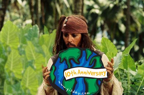
International Talk Like A Pirate Day 2008
Avast, me hearties!
’Tis that time once again, International Talk Like A Pirate Day Tide be here. Ye better learn t’ talk like a seafarin’ hearty today or else ye`ll look like a fool. Raise yer grog mugs an’ celebrate. If Captain Jack Sparrow can take th’ time t’ get involved wi’ his local GIS Tide presentations, ye can talk like a seafarin’ hearty.
Captain Jack is teaching is crew about GIS today.
 Captain Jack is teaching is crew about GIS today.
We’ve had very busy week!
For everyone who keeps telling me that this “geospatial space” is boring these days, you have obviously not been paying attention. Loads of great stuff has been been posted:
- Thanks to everyone who sent this link in (Bill, Dan, John, Barry, Alan, APB). ESRI has compiled essays from their publications into a GIS Best Practices whitepaper. Good for all those who like to pile your ArcNews in the corner of your office to show how important you are.
- Dave Peter’s great whitepaper on System Design Strategies has been updated and on its 25th edition. Many were relieved to hear that he is going to continue updating the paper even after his new book (which I have an plan to start reading next week while traveling).
- Peter Batty continues to write about Netezza’s new spatial product. He blogged about why this performance is important and where it is going to be used. Of course I doubt I’ll be seeing it replace our SQL Server 2008 anytime soon but this could be the direction we are all moving toward. He also posted a video interview with Rich Zimmerman who was the lead developer on Netezza’s spatial extension. Well worth watching if you want to hear how someone could take PostgreSQL and turn it into a monster.
- Jithen blogged about updating the ArcGIS 9.3 SP1 announcement and how many more bugs they’ve fixed. It really is amazing how their new crash reporting tools allows them to find and fix bugs faster than before. I suspect we’ll see later service packs much smaller than they were at 9.2 given that they are able to trap the errors much easier. I’m still on 9.2 (this will be resolved very soon) so I have to watch the fun from afar.
- Sean Gorman, bless his heart, has followed up his GeoWeb blog ranking list post. I think Technorati isn’t work the time it takes me to type it, but the idea that he wants to develop a blog list is interesting to me and if he/we can come up with a good ranking scheme, it could be very useful to seeing changes with blogs over time.
- Lastly, Microsoft is going to have a couple webcasts about Virtual Earth. Mark Brown posted information about a Virtual Earth 6.2 Technical Webcast October 3rd at 10am PDT and Chris Pendleton has one called Momentum Webcast: See More and Do More with Microsoft Virtual Earth October 2 at 9AM PDT.
Even Mark Twain is interested in reading Dave Peters new book
 Even Mark Twain is interested in reading Dave Peters new book
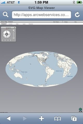
Using SVG to create interactive maps on the Apple iPhone
So you can’t have Silverlight, Java or Flash to develop interactive mapping on the iPhone and have to “resort” to using JavaScript. Well maybe not, could SVG be the way forward to creating mapping websites on the iPhone?? My 2G iPhone seems to support SVG fairly well, but many SVG sites aren’t optimized for the iPhone. Take ESRI’s abandoned (?) SVG Viewer:
ESRI’s ArcWeb SVG Viewer
 ESRIs ArcWeb SVG Viewer
It loads and you can turn on and off the “widgets” with ease. But navigating it was impossible. I know zero about developing with SVG so I suppose someone else will have to comment on if it is possible to create iPhone compatible navigation for SVG apps. Heck if ESRI were to make a ArcGIS Server SVG API compatible for the iPhone, every ArcGIS Server implementation would be viewable on the iPhone.